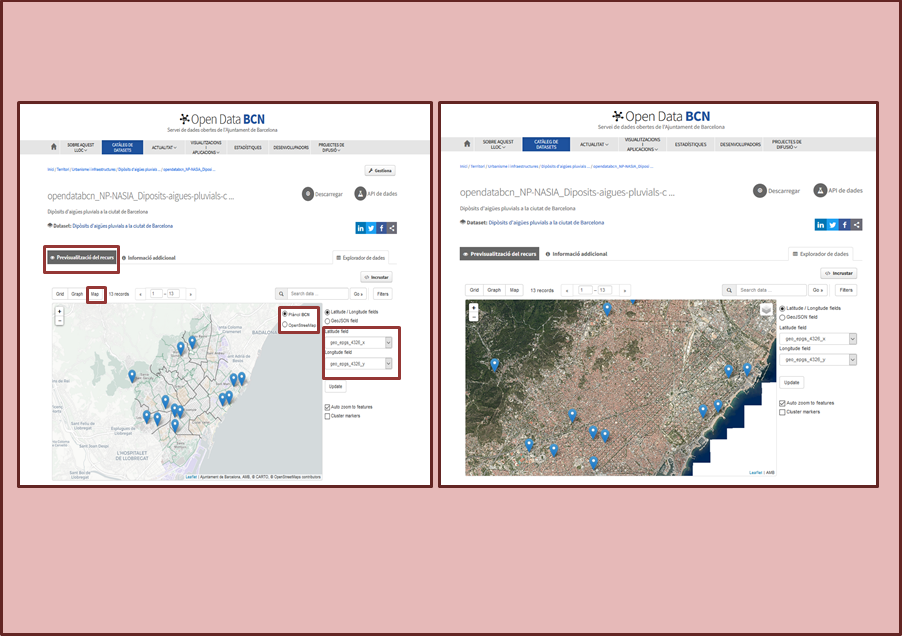
The geolocated data with the WGS 84 system (Latitude-Longitude) published in the Open Data BCN portal can now be previsualized in the section ‘Resource previsualization’ on the BCN Map and on the Aerial Image of the city, asides from the OpenStreetMap base.
The layer selector in the upper right corener of the map allows this selection.
An improvement is also incorporated in which, with the majority of the resources, the coordinates appear preselected in the fields ‘Latitude field’ and ‘Longitude field’. If that is not the case, it will be necessary to select them manually and press the 'Update' button.
Add new comment
Log in or register to post comments